

Reading Time:
1-2 Minutes
Oct 21, 2024
When hurricanes like Helene and Milton strike, public adjusters are often faced with the challenge of managing a high volume of complex claims in a short time. Assessing property damage quickly and accurately is critical to ensuring fair settlements, but traditional methods can be time-consuming and imprecise. We offer a powerful solution, using satellite imagery and advanced analytics to streamline flood damage detection and provide adjusters with precise, actionable data. This allows public adjusters to locate damaged properties, expedite claims, improve accuracy, and serve their clients more effectively.
The Power of Satellite Imagery
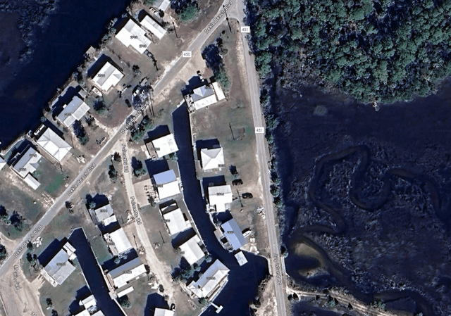
At Dorothy, we leverage innovative satellite technology to quickly assess flood damage before and after a hurricane, providing accurate data of affected properties to public adjusters. With high-resolution satellite images, such as those used in the aftermath of Hurricane Helene and Hurricane Milton, our platform can detect flooding areas, analyze property impact, and create detailed reports to assist with insurance claims. By comparing pre and post-flood imagery, our system identifies affected properties and delivers critical insights.
For example, in our recent study of Hurricane Ida, our flood detection system analyzed over 14,000 properties in a flood zone, with nearly 20% identified as impacted by floodwaters. This level of precision ensures that public adjusters locate damaged properties faster, and have the data they need to advocate for fair compensation on behalf of their clients. Our automated method of assessing damage means that public adjusters can focus impacted properties faster and on the claims process, rather than spending hours on-site evaluations.
Connecting Policyholders with Public Adjusters
Source: National Oceanic and Atmospheric Administration
Dorothy isn’t just about data; it’s also a tool for connecting policyholders with experienced public adjusters who specialize in handling property damage — like hurricane claims. Public adjusters play a crucial role in navigating the insurance landscape, ensuring that homeowners and business owners receive fair settlements for their losses.
Using satellite imagery and our historical claims data, we equip public adjusters with the information they need to represent their clients confidently. For policyholders, this means faster claim processing and peace of mind, knowing that a professional is advocating for their best interests.
Why Dorothy is Essential for Hurricane Response
In the wake of a hurricane, time is of the essence. With thousands of claims filed in a short period, insurance companies are often overwhelmed, leading to delays in payouts and underestimations of damage. Dorothy bridges this gap by providing real-time data through satellite imagery and connecting policyholders with skilled public adjusters. This combination allows claims to be processed efficiently and fairly, reducing the overall time it takes for individuals to recover from such a disaster. Get started today.
